Cartographic Design Portfolio
Cartography collection featuring population density, river systems, and topographic visualizations
Overview
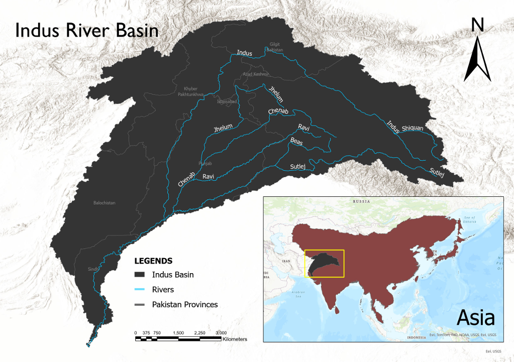
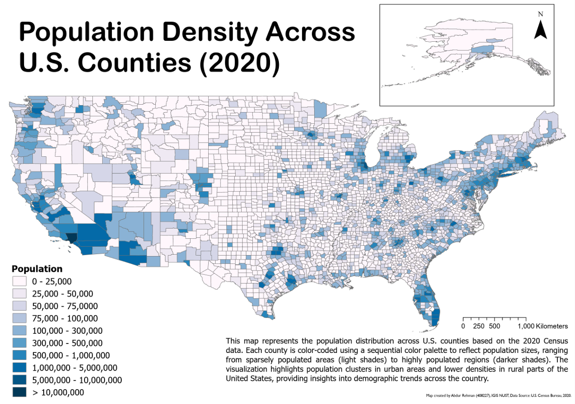
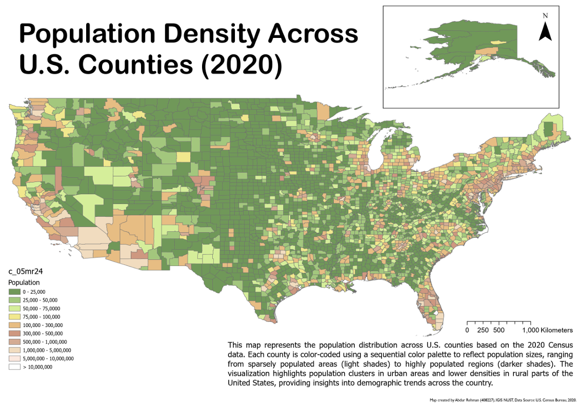
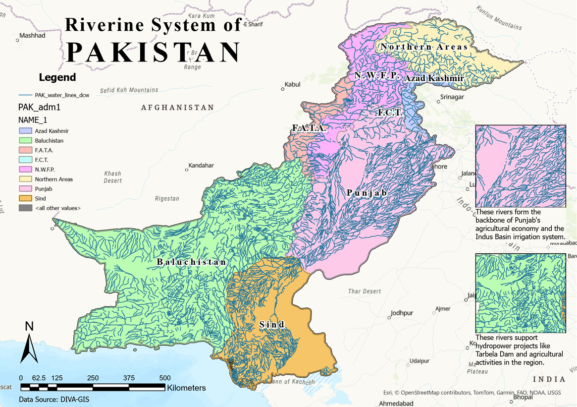
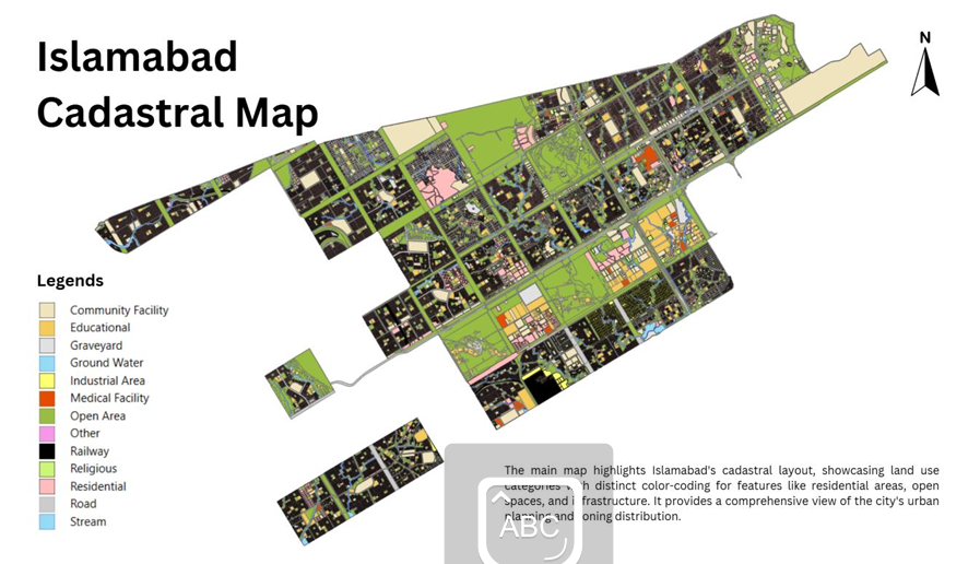
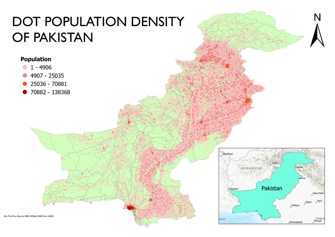
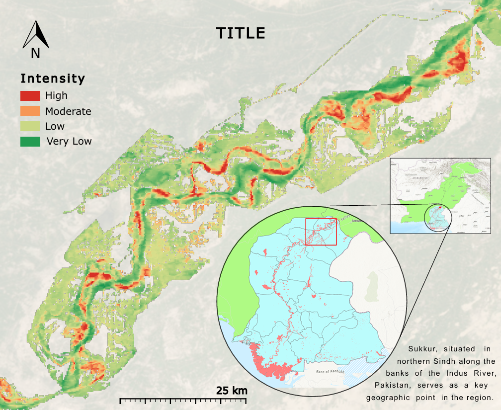
A comprehensive collection of cartographic works showcasing spatial data visualization and geographic communication skills. Features diverse maps including dot density population maps of Pakistan, cadastral mapping of Islamabad with detailed land use classifications, comprehensive riverine system mapping of Pakistan showing provincial boundaries and hydrological networks, population density analysis across U.S.
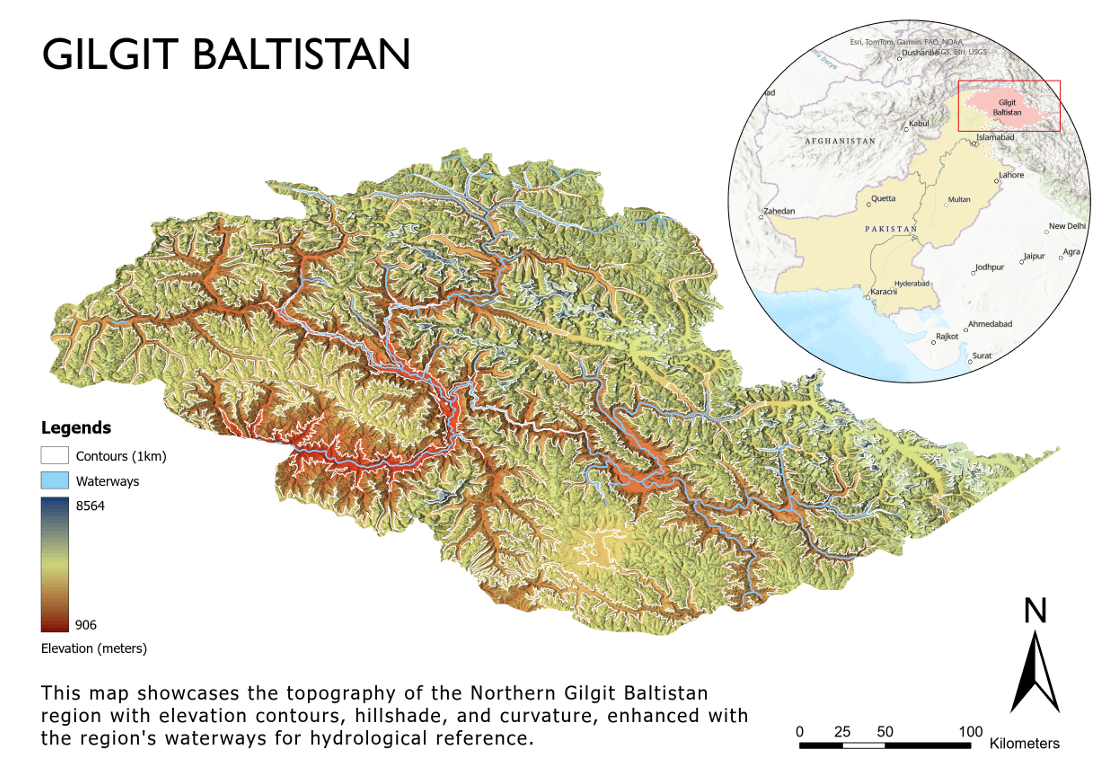
counties using choropleth and dot density techniques, Indus River Basin mapping with detailed watershed delineation, and topographic visualization of Gilgit Baltistan with elevation contours and hillshade effects. Each map demonstrates expertise in cartographic design principles, color theory, spatial hierarchy, and effective visual communication of complex geographic information.
Project Gallery